Coastguard's Beach, Bigbury-on-Sea, South Devon

Beach on the west side of the Erme Estuary
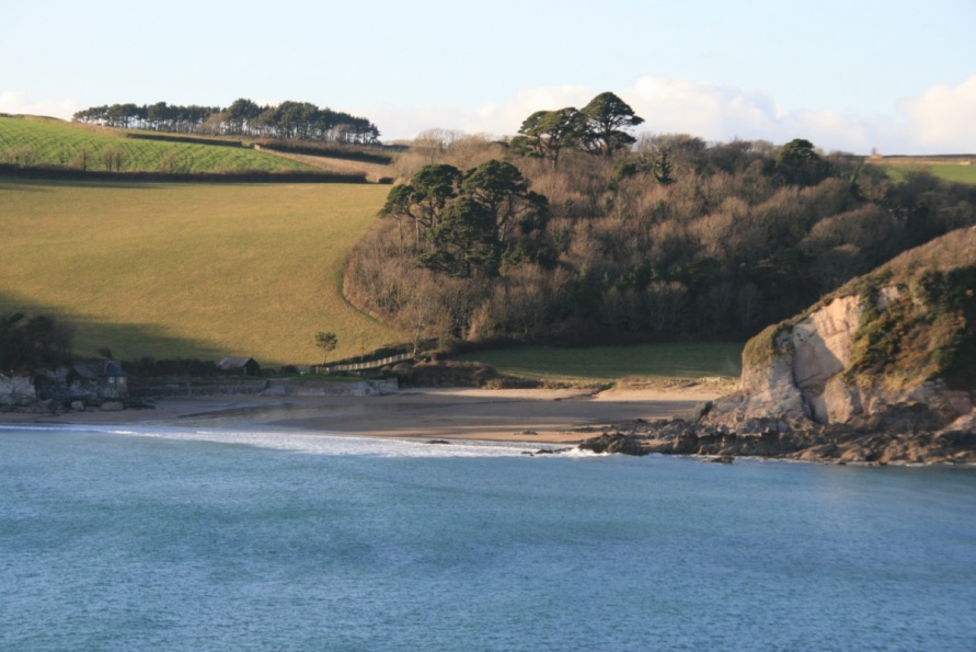
Coastguard's Beach is situated on the west side of the Erme Estuary. At low tide, it becomes part of a huge stretch of sand running north east. You'll often see horse riders using the beach. Wonwell Beach is across the water.
Mothecombe Beach, also known as Meadowsfoot Beach on Ordnance Survey mapping, is to the south west beyond Owen's Hill and Owen's Point. The beaches connect at low tide. The South West Coast Path connects both beaches at high tide.
Note that if you are walking the South West Coast Path and want to cross the Erme then you have to ford the river channel further up the beach. There are local information boards providing crossing advice. See below. Also refer to Ordnance Survey mapping for location detail. Clearly, you can't ford the river channel at high tide so plan to cross when the water is low at, or around, low tide.
Location of Mothecombe Beach
We've positioned Coastguard's Beach on Google maps. Zoom in on the 'Satellite' setting to see its location.
Crossing the River Erme and Estuary
There's a large car parking area behind Coastguard's Beach and Mothecombe (Meadowsfoot) Beach. A road runs east of this car parking area to a slipway that leads down to the rock, shingle and sand Coastgaurd's Beach. At the top of this slipway are information boards with visuals of the crossing point. These information boards also provide the following advice:
'The River Erme can usually be waded for 1 hour either side of low tide by crossing between the two slipways as shown on the photograph. However care should be taken as heavy rains or seas can make the crossing dangerous. The times of low water are shown in the table below. Also provided, for when it's not possible to ford the river, are directions for walking around it and phone numbers for local taxi firms.
Walking around the river. As there are no public footpaths running along the sides of the estuary this entails a 7 mile walk mainly on country lanes. To do this follow the lane uphill to Mothecombe village, bear right taking signs for the village of Holbeton. From Holbeton centre, head to the hamlet of Ford along Vicarage Hill. Bear right near Hole Farm on to the bridleway of the waymarked Erme-Plym Trail until you reach the A379. Turn right crossing Sequer's Bridge and take the first lane on your right, past Orcheton to Great Torr. Turn right then left and follow signs to Wonwell beach.'
Photo Gallery